


Geomagnetic survey in Teleac 2017 (RO)
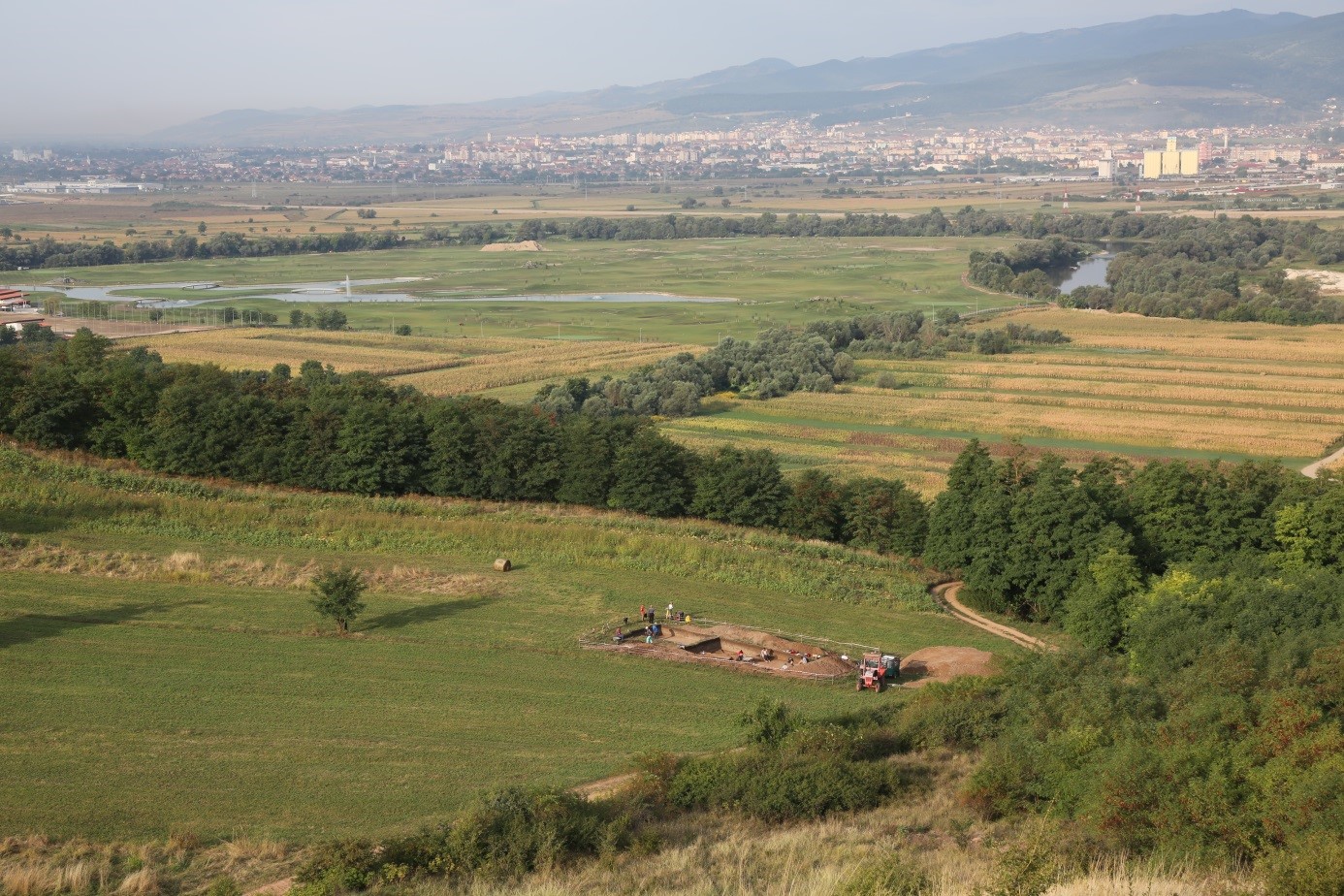
We conducted a third geomagnetic survey of Teleac during three weeks in April of 2017. The aims this season were to plug gaps in the magnetogram inside the hillfort and to continue surveying areas outside the fortification system. Like previous surveys, we used a five channel Sensys MX-5 DGPS magnetometer. Although we were mostly working in difficult terrain, we managed to survey more than 10 hectares, making the total surveyed area in Teleac 32 hectares.
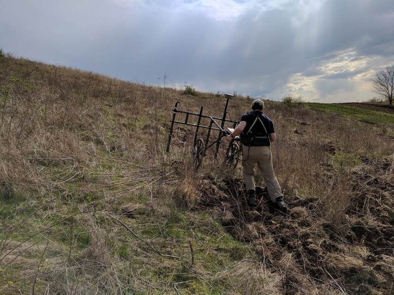 |
Picture 1: Surveying difficult terrain inside the hillfort |
The new areas surveyed reinforce the picture that most parts with suitable terrain inside the hillfort were habited, which stand in stark contrast to areas outside the fortification system that are essentially empty of anomalies. That these areas were kept clear underscores that the substantial ditch and rampart system were not just for show, as these open areas denied potential attackers the use of cover during an assault.
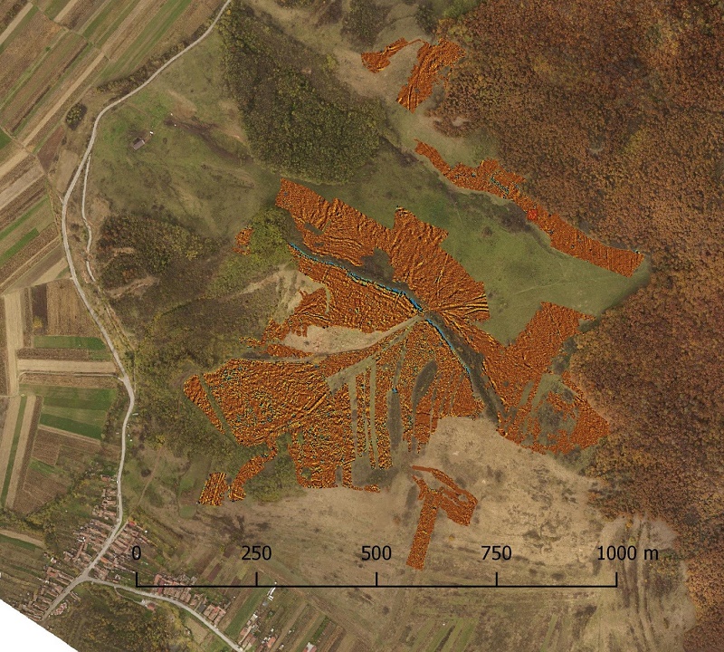 |
Picture 2: Orthophoto and magnetogram of the Teleac hillfort and immediately surrounding areas. The blue band with high nanotesla values at the centre of the photo marks the hillfort’s northern rampart. |
As part of the preparations for the excavations in the summer of 2017 we also investigated by drilling geomagnetic anomalies and the thickness of the cultural layers at the lower settlement in Teleac. We could determine that the cultural layers had a depth of up to 2 meters, which makes evident long term intensive settlement activities at this part of the site, similar to previously investigated areas close to the fortification system.
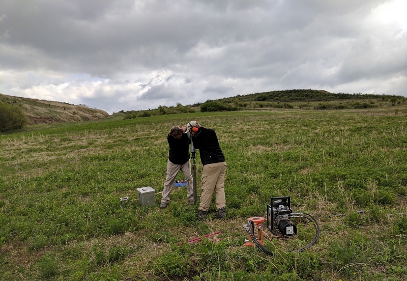 |
Picture 3: Drilling anomalies at the lower settlement. |
(Author Claes Uhnér)
Excavations in Teleac 2017 (RO)
| In 2017 the Prehistoric conflict research project conducted excavations in Teleac from the end of June to the first week in September. Similar to the excavations in 2016, we staked out the locations of two new trenches based on information from the geophysical prospection of the site, and we continued working in the 10 x 10 meter trench 1 we started last year in the upper, northern part of the hillfort. As before, the general aims of the excavations are to investigate the internal structure and local economy of the settlement. | 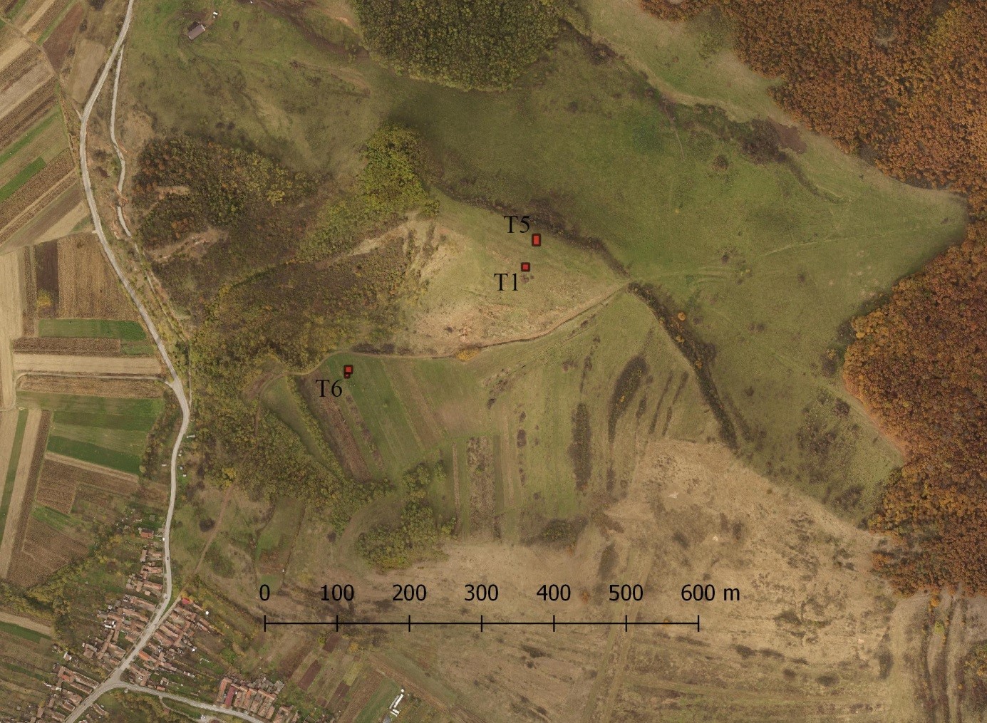 |
| Picture 1: The locations of the trenches excavated in Teleac during 2017. T1 and T5 are positioned on the Gruşet plateau in the upper settlement, and T6 is located in the lower settlement. The band of vegetation just north of trench 5 marks the hillfort’s north-eastern defensive system (orthophoto by Johannes Kalmbach RGK) |
 |
The new 10 x 10 meter trench 6 is located in the lower settlement, close to a road that leads from west to east through the hillfort. Trench 6 has typical settlement features such as pits and large daub concentrations, and we have started to investigate what might be two large sunken buildings. Geophysical survey of the lower settlement indicates that the lower settlement was densely populated, and the excavation results from this year are in line with what can be seen on the magnetogram. |
| Picture 2: Trench 6 overlooking the Mureş valley and the city of Alba Iulia in the distance. |
| Trench 1 is located in the middle of an about 170 x 70 meter area with magnetic anomalies indicative of fire installations in the upper settlement. In 2016 we found several ovens and kilns, and this year we could document a similar picture. Although none of the new features were as well preserved as last year, it seems that the fire installations were protected by a roof, as we found a line with three clay-lined postholes traversing the southern half of the trench from north to south. The area was apparently used for high temperature production activities for a long time since we encountered fire installations on several chronological levels and because two large ovens had been rebuilt. | 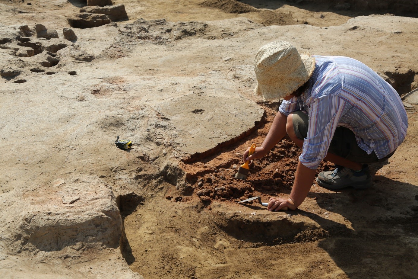 |
| Picture 3: Excavating the base on a rebuilt oven in trench 1. |
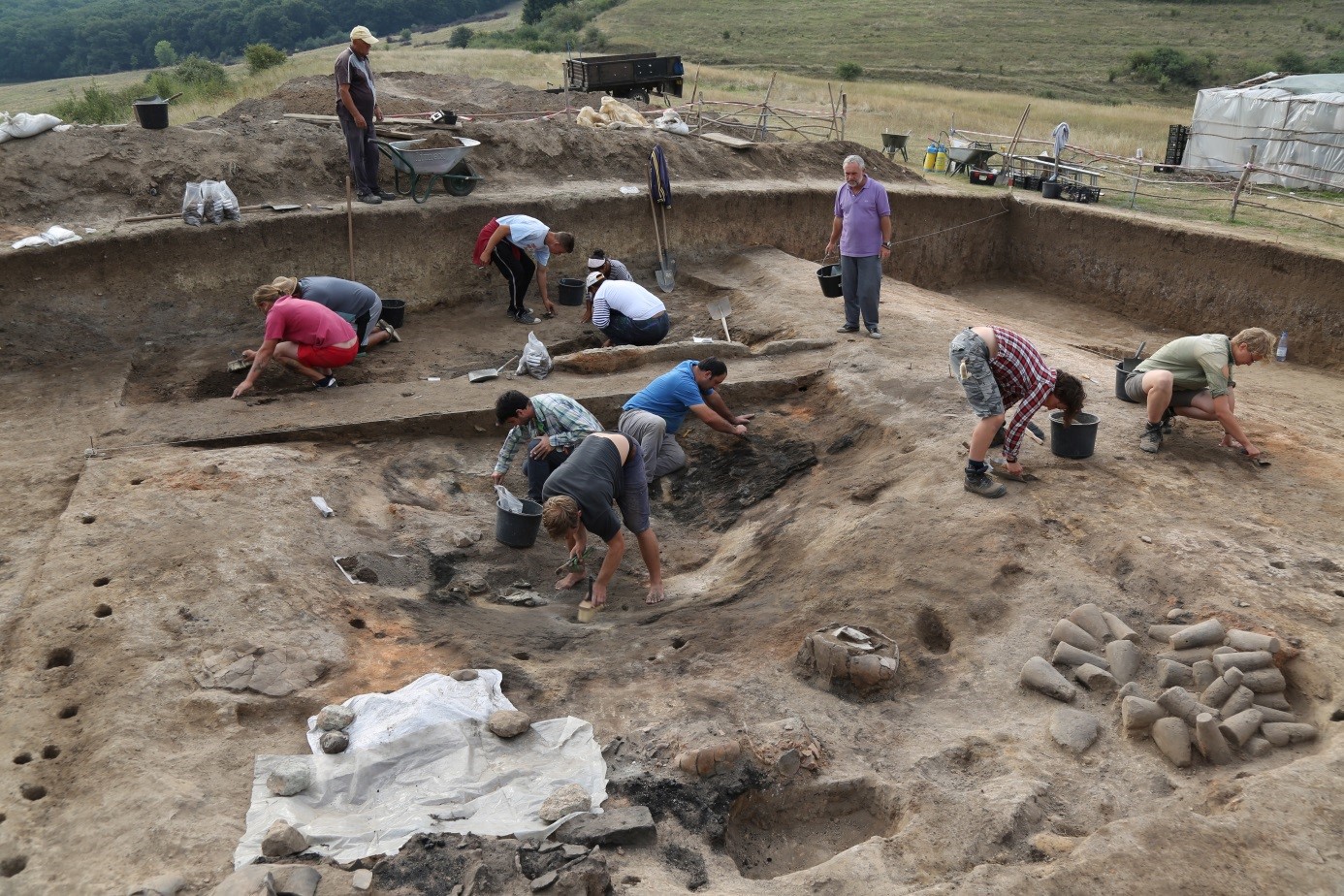 |
The most interesting trench was the 10 x 16 meter T5 by the hillfort’s northern fortification system. Here we could determine that the inner rampart was destroyed by fire together with an adjacent 9 x 6 meter large building, which was sealed by debris and therefore very well preserved. The walls of the building were built around two rows of stake holes, and the structure has two substantial post holes for holding up the centre of the roof. The western part of the building was apparently used for storage, and here we found 30 large conical loom weights along with several vessels of varying sizes, many of which contained charred grain. Further east in the building we found a large well-preserved part of the wall, whereas the north-eastern corner of the building had an oven next to a large collapsed clay installation. |
| Picture 4: Excavating a building in trench 5. |
| The 2017 campaign in Teleac shows a strong agreement between the geophysical survey data and features found during excavation, and when combining the two data sets we are getting a better understanding of the spatial organisation of the hillfort. It seems that the more than 10 ha large lower settlement had the densest occupation. Most buildings at the upper settlement were built close to the inner fortification rampart, and this habitation zone was separated by an empty strip of land from a large area that appears to have been set aside for high temperature production activities. Taken together, it seems that Teleac was a spatially well organised settlement where some areas were set aside for specific activities. | |
(Author und Photograph Dr. Claés Uhnér)